


An emotional journey between history and nature. A demanding tour with 2400 meters of elevation gain, on the tracks of the 'World War I'
The Epic Tour Grande Guerra is a top MTB experience in Val di Sole (Trentino, Northern Italy) and the adjective 'Epic' says it all. An emotional tour on the tracks connecting the Tonale Pass with the Val di Peio: the Epic Tour Grande Guerra winds through beautiful landscapes, challenging climbs and breathtaking downhills, in one of the most charming and unspoiled scenarios of the Val di Sole.
However, this tour does not only combine sports and nature: thanks to the Epic Tour Grande Guerra is possible to relive Italy's history through the remains of the World War I trenches.
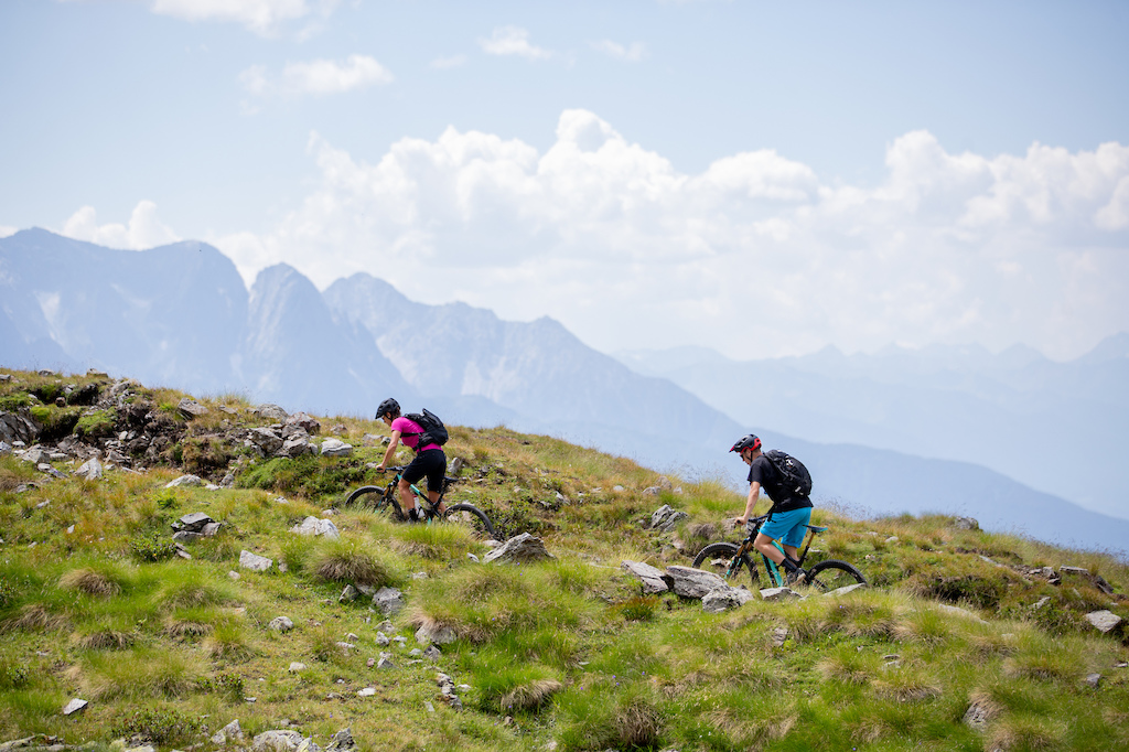
The start of the tour is located in Ossana (979 mt.), followed by 59 Km of trails with a total elevation gain of 2400 mt. Riders will climb up to 2611 mt, where the air is thin, and good training is required to finish a course characterized by the remains of the 'Great War'. The Epic Tour is a route for trained bikers, also open to E-Bikes: it is advised to ride a Full-Suspension All-Mountain/Enduro bike, to face in the best way the downhill trail leading to the Pian Palù Lake.
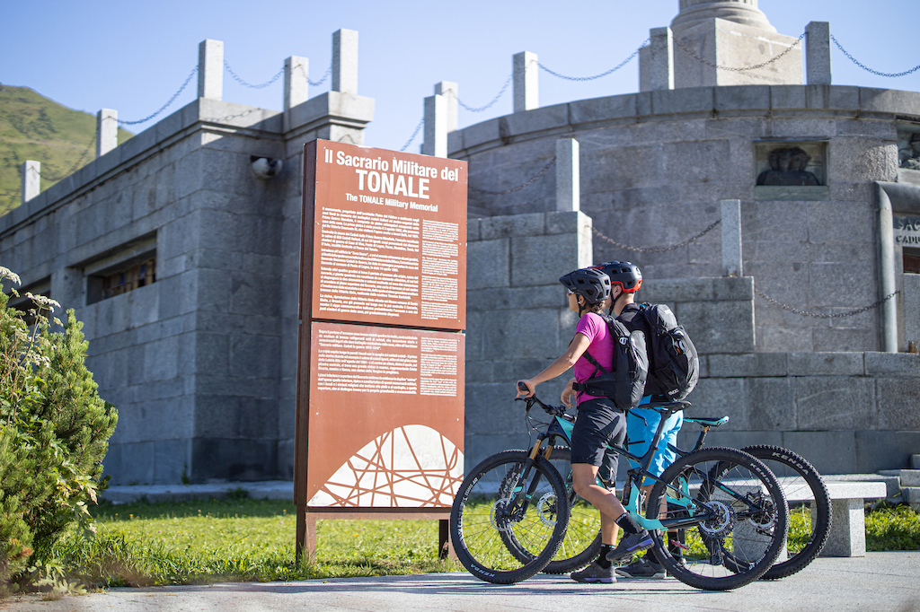
From Ossana, the forest road passes Vermiglio and climbs to the Tonale Pass (1850 mt.). At the summit, the riders pass near the military shrine between Lombardy and Trentino.
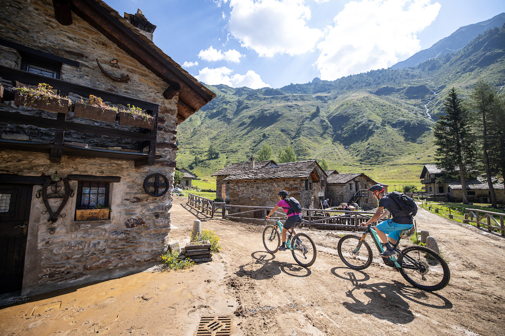
Halfway down the long descent to Ponte di Legno, following the direction towards 'Tonalina', a forest road connects to Valle di Viso and the village of Case di Viso. A walk through the old stone buildings characterizing Case di Viso is like travelling back in time, together with the fragrance of local cheese.
After Case di Viso, the rise begins towards Rifugio Bozzi and Forcellina del Montozzo, the highest point of the tour (2611 mt). The road slopes into the mountain through narrow hairpin bends: a great effort rewarded by a magnificent view over Ortles-Cevedale and the Valle di Viso.
 Shortly before reaching the top, the Bozzi mountain hut (2468 m.) offers the opportunity for a tasty break. Right there, the first remains of the Great War can be found, between trenches and museums open to the public. The first lesson of contemporary history in the open, but not the last.
From the hut, the Forcellina del Montozzo can be seen. It seems close, 200 more meters in altitude have to be covered in less than a kilometer, with an average gradient of more than 20%. To tackle the last stretch, a little portage is recommended, but the sacrifice, once again, won’t be in vain.
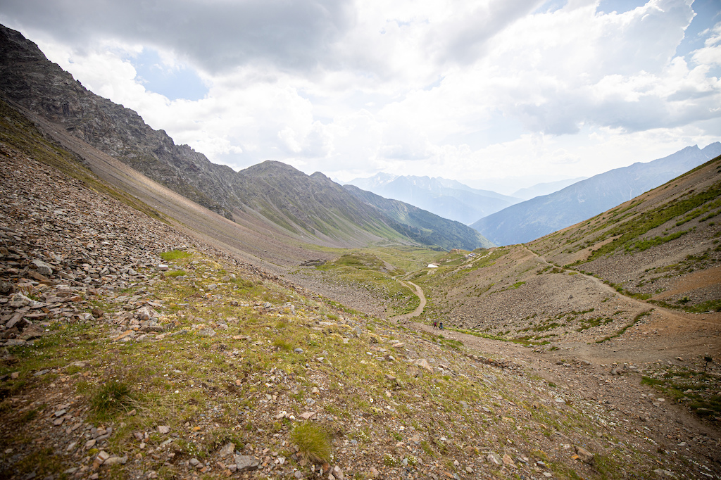 From the top, a different world discloses in front of the eyes. The scenario twists. The view opens on the peaks of the Ortles-Cevedale and the Val di Peio. A valley that seems infinite. Nearby are the remains of the trenches that hosted the Italian soldiers during the liberation war against the Hapsburg army.
At that point, the downhill begins: the path is not technically demanding, but the most experienced riders will be able to find a deviation, a jump, a natural passage to test themselves out. Once the valley is ended, the Pian Palù Lake starts to emerge. The rocky section begins, the path becomes narrow and more technical. The slopes increase.
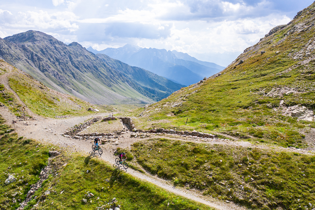
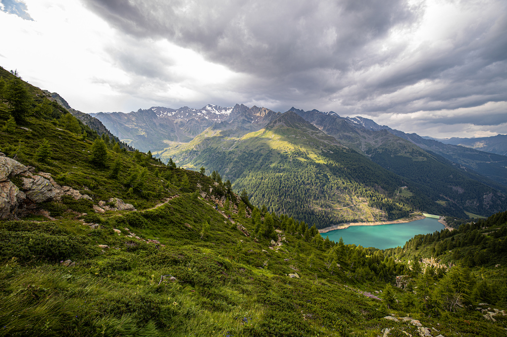
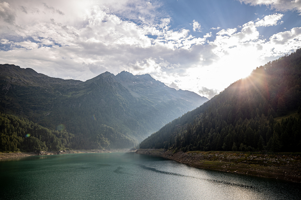
After crossing a watercourse, the path enters the wood. Despite the roots, the route is not overly technical. At that point, we reach the shores of the lake, collecting the waters of the surrounding glaciers. A break is mandatory, before getting back on the path - alternatively the forest road - towards Peio Fonti.
From Peio, the ride down towards Cogolo di Peio leads to the beginning of the Noce cycling path, for a smooth and easy return to the starting point of the course in Ossana.
CHARACTERISTICS OF THE TOUR
• Length: 59 Km
• Duration: around 8 hours
• Elevation gain: 2431 m.
• Difficulty: S4 - Difficult
HOW TO GET THERE
From Bergamo/Brescia follow the SS42 towards Passo del Tonale. From Bologna / Verona and the Brenner Pass, follow the A22 until San Michele exist. Continue towards Cles, Val di Non, along the SS43 and, after passing Cles, take the SS42 towards Passo del Tonale.
PUBLIC TRANSPORT
Possibility to reach Passo del Tonale by bike bus, adequately equipped with a 22 bike trolley.
WHERE TO PARK
Bus parking in Fucine di Ossana.
COORDINATES
DD 46.310311, 10.730137
DMS 46 ° 18'37.1 "N 10 ° 43'48.5" E
UTM 32T 633216 5129980
OTHER INFORMATION
If you intend to tackle the route after 20 September, the Bozzi Hut is closed. Pocket lunches are recommended.
CLICK HERE for more information.